Software - Enterprise Redistricting Solution
Citygate offers Enterprise Redistricting Solution designed to support every aspect of the redistricting process. The solutions are integrated which means plans created on the desktop are readily available to web users, and as viewable plans on the web based plan viewer.Learn More...
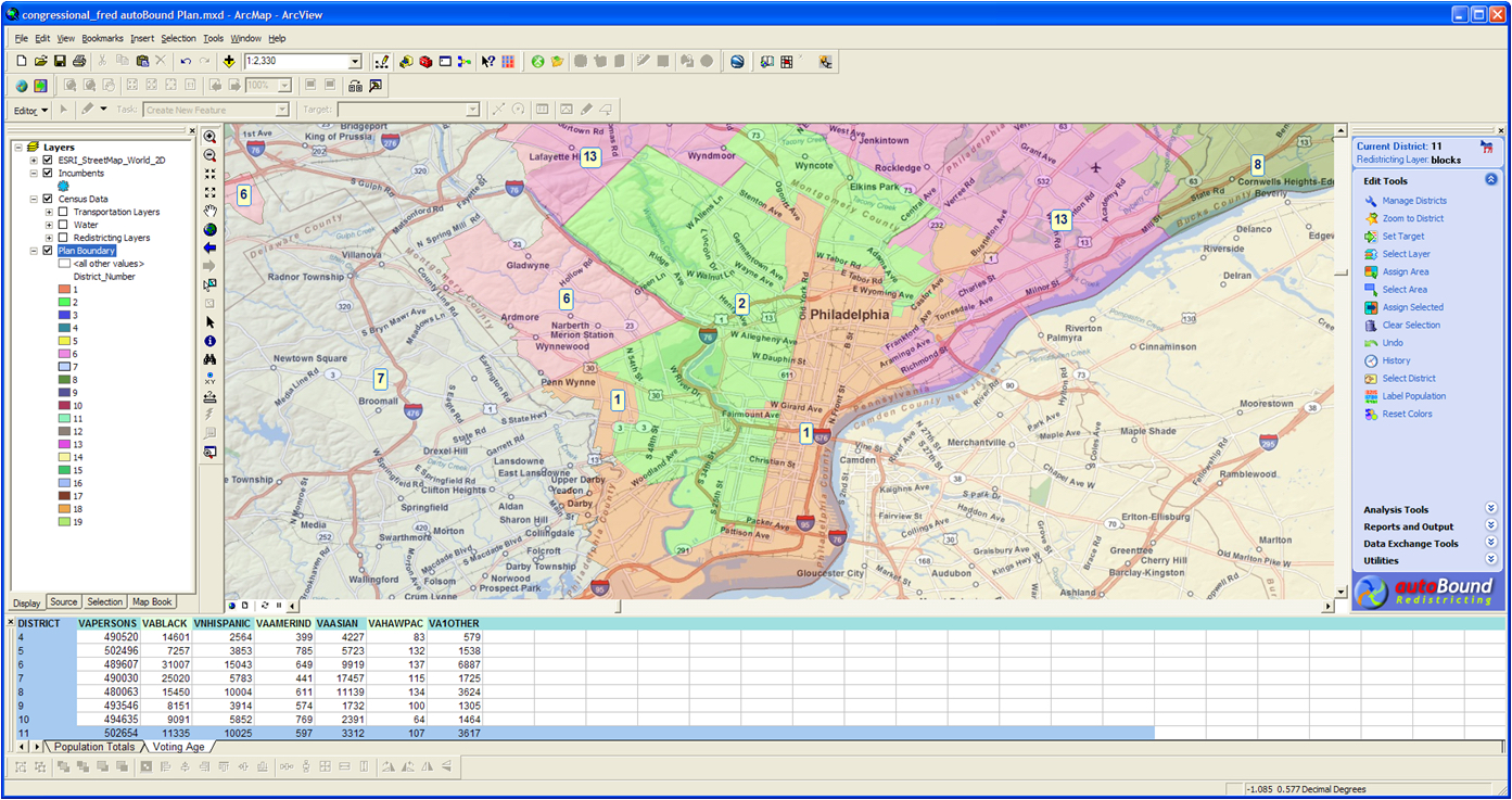
autoBound is a complete redistricting solution which supports every aspect of redistricting; from data development to plan creation to final reports and maps. The first version of the software was released in 1994 and was the primary redistricting application used in over 40 states for creating the 2000 and 2010 Congressional and Legislative districts. Autobound has also been adopted for use in other countries, including in Canada for country wide FED redistricting.
autoBound runs in conjunction with ESRI’s Arcview GIS. Citygate’s also provides autoBound LE. AutoBound LE is a standalone application based on ESRI’s ArcEngine technology and allows users to develop and edit redistricting plans without the need to install and learn GIS software.
autoBound provides the following capabilities:
- - Easy to setup, simple to learn and use
- - Advanced boundary editing tools
- - Multi-level redistricting
- - Feature level grouping and locking
- - Includes intelligent automated redistricting
- - Unlimited number of undos and set points
- - Integrated Excel compatible spread sheet tool
- - Wizard driven user interface simplifies most tasks
- - Centralized Workspace manager
- - Census Geography data import tool imports directly from CD
- - One button Export to Google Earth
- - Intelligent contiguity analyzer
- - 5 built in and user defined compactness measurements
- - Import/Export plans to other GIS
- - Direct output to the Internet
- - Built in security features prevents unauthorized edits
- - Includes address matching/geocoding
- - Advanced mapping tools and hard copy production tools
- - Built in Professional Report writer
- - Supports user developed data sets
- - Includes online access to all Census Redistricting data for the US
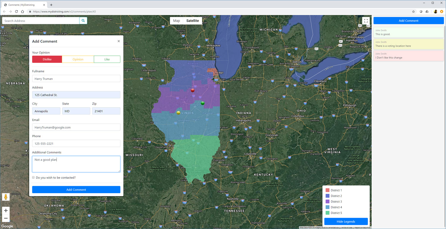

As redistricting plans are created, there may be interest in soliciting comments either internally or from members of the public. iOpenEngage is a web based application which provides tools for public engagement. iOpenEngage uses Google Maps as a backdrop to display the proposed redistricting plans and provide statistics on each proposed plan. Members of the public can view districts and if interested, place comments on the map.
The system offers the following capabilities:
- - Integrates with Citygate's desktop redistricting software
- - Web based
- - Highly customizable
- - Geospatial Commenting
- - Documents individual concerns
- - GIS Compatible
- - Can be configured to show previous comments or only the users own
- - Available as an on-premise solution or as a hosted service
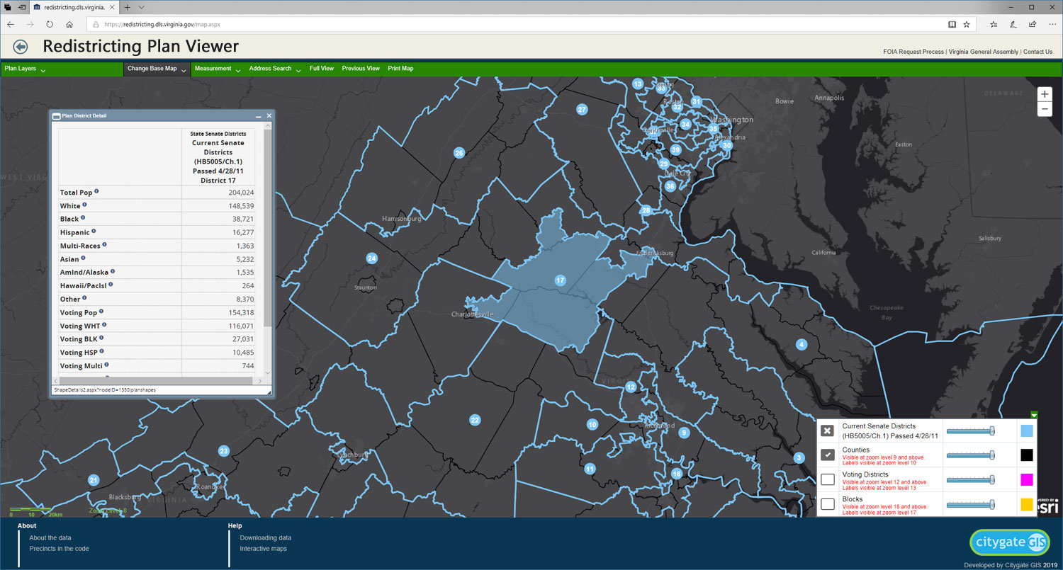
REDISTRICTING PLAN VIEWER is a web based solution for displaying redistricting bills and adopted plans. The system provides the following capabilities:
- - Integrates with Citygate's desktop redistricting software
- - Provides demographics across multiple plans
- - Allows for plan comparisons
- - Provides reporting and map creation tools
- - Import and Export functions
- - Integrates with Bill Drafting Systems
- - Provides district lookup as a web service
- - Available as on-premise or as hosted Software as a Service
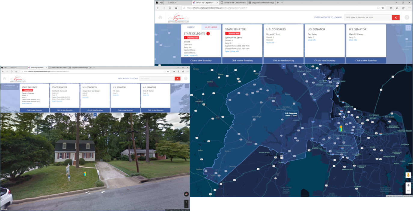
WHO-IS-MY-LEGISLATOR is a web based solution for identifying representatives based on address or map location. The system provides the following capabilities:
- - Integrates with the Redistricting plan viewer and Citygate's desktop redistricting software
- - Identifies representatives from House, Senate, Congressional or local districts
- - Supports court ordered plan effective dates
- - 10 Base Map options, including Google imagery and Steet views
- - ADA Compliant
- - Available as on-premise or as hosted Software as a Service
Interested?